Start Your Hunt At Home

I am an unabashed, unapologetic Luddite. (And yes, I do recognize the irony of making that declaration via the internet). What’s true for my home life is doubly so for my days afield. When I head for the hills, I’m looking to unplug completely. The thought of the latest technological gewgaw hitching a ride in my pack makes me breakout in a cold sweat.
But there are exceptions to every rule. Recently, I’ve started using a distinctly high tech (though not exactly new) tool to make the most of my time in the woods. And perhaps the best part… when I leave the house, it stays behind.
Exploring new territory, both in season and on off-season scouting missions, is one of the best aspects of hunting. The sense of adventure that comes from not knowing what’s around the next bend is something we just don’t get enough of in our daily lives. Unfortunately the other thing we rarely get enough of is time. Wyoming is a big place. Hunt area boundaries often enclose hundreds of square miles, and it’s nothing for your deer tag, elk tag and antelope tag to each be three hours of highway from town… in opposite directions. When you crunch those figures with the number of days available to scout and hunt, the need for strategic efficiencies adds up in a hurry.
Enter Google Earth
Now let’s be clear. You can have my maps when you pry them from my cold dead hands. There’s just no replacing the functionality, reliability or day-dream quality asthetics of old-school USGS topo quads. But as a scouting and planning tool, they do have limitations.
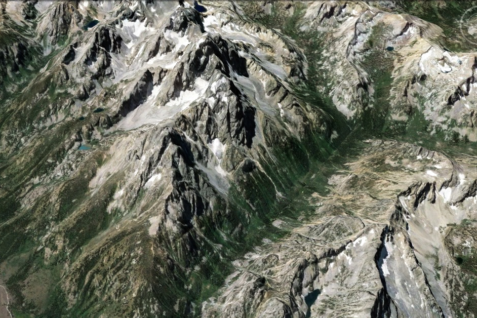
Is that big green patch nice broken timber or acre upon acre of unnavigable dog hair? Is that meadow still a meadow, or has it grown up in the 30 years since the map was made? Does that knob offer a view of the surrounding country or is it all hemmed in with tall trees? You can take your map for a three hour drive and a five mile hike to answer these questions or, with Google Earth, you can find out in fifteen seconds from your living room.
Of course, just as Google Earth will never replace a good map (and the knowledge of how to use it), neither are substitutes for time on the landscape. I’m all for the aimless walk in the woods. In my experience, they tend to be the most illuminating. But the fact of the matter is, I only get to take so many of them. Do I point my boots up Canyon A? over Ridge B, or should I have parked the truck five-miles to the south at a completely different trailhead? Google earth helps identify the most promising options from an infinite number of possibilities. This tool isn’t about cutting your scouting time. It’s about making the most of it.
And if it contributes to a few extra hours of daydreaming in the off season? Well, so much the better.


Awesome blog, just found it the other day. Google earth saved me big time this year when it came to access. Pulling coordinates off GE and converting/plugging them into my GPS for each turn I needed to take made for more time hunting and less time cruising random two-tracks (easy to do here in NE Nevada)…Keep up the good work!
Thanks Tom. I’ll be honest… you pretty well outdistanced the depth of my Google Earth expertise there, but I’m glad to learn that the more savvy you are the more utility they provide. Are you up in the Owyhee country then?
If you care to give it a try let me know and I’ll write the steps down/email them to you. It’s pretty straight forward. I’m from Elko, so kind of close to Owyhee. I spend a lot of time in the mountains SE of the Owyhee reservation hunting Chukar and Huns.
Oh man, that would be awesome! Thanks Tom!
Here’s a link to an ESRI mapping product that you might find useful. It allows you to access base maps of the same quality as Google Earth (it would require Google Earth Pro at $400.00 to do most of what this will do for free) while providing tools for creating custom maps with photo insets, route and way point planning, along with some limited analysis tools; tools that could be used to plot harvest data for specific areas that should be available from your state Fish & Wildlife.
As part of my job I do some very limited GIS analysis and mapping using ArcGIS Desktop. I’m not 100% certain of the full capabilities of the Explorer application but it may be worth a little additional time, on your part, to expand the capabilities of the tools you do make use of. Don’t hold me to it but I think you might be able to plot the maps you create so you could have custom maps to take to the field.
I know it’s not in complete accord with the Luddite creed but, hey, those guys weren’t focused on trophy elk. Feel free to get in touch with me and I’ll try to give you what direction I can using the application.
http://www.esri.com/software/arcgis/explorer
Thanks a bunch Gary! That’s super helpful. I’ll be sure and check it out.